Table of Contents >> Show >> Hide
- What Are Data Buoys, Exactly?
- Why Data Buoys Matter for Weather and Ocean Forecasting
- How Buoys Help Scientists Track Climate Signals
- Data Buoys and Disaster Warnings
- Why Satellites Cannot Do It Alone
- The Hidden Engineering Behind Every Buoy
- Who Uses Ocean Buoy Data?
- The Future of Keeping Watch Over the Oceans
- Conclusion
- Experience Section: What It Feels Like to Rely on Data Buoys
- SEO Tags
The ocean is large, moody, and not especially interested in making life easy for scientists. It covers more than 70 percent of Earth, changes by the minute, and has a talent for turning a calm-looking horizon into a full-blown problem. That is exactly why data buoys matter. These floating sentinels sit offshore collecting wave, wind, temperature, pressure, salinity, and other measurements that help researchers, mariners, forecasters, and coastal communities understand what the sea is doing now and what it might do next.
If satellites give us the big picture, data buoys give us the close-up. They are the ocean’s field reporters: always on location, never sleeping, and not complaining about night shifts. From hurricane forecasts and tsunami warnings to fisheries management and climate research, buoy networks quietly power decisions that affect safety, commerce, and environmental planning every single day. In short, if the ocean had a pulse monitor, data buoys would be a big part of it.
What Are Data Buoys, Exactly?
Data buoys are floating or moored observing platforms equipped with sensors that record oceanographic and meteorological conditions. Some remain anchored in one location for years, building a long time series from the same patch of ocean. Others drift with currents, helping scientists understand how water moves across the surface. Some are designed for nearshore waters, while others work far offshore in punishing conditions where the only regular visitors are seabirds, storms, and the occasional deeply annoyed maintenance crew.
At their simplest, data buoys are smart platforms that gather information and transmit it back to shore in near real time. At their most sophisticated, they become mini observing stations that support weather prediction, climate monitoring, marine research, and hazard response. A modern buoy can do far more than bob around looking photogenic. It can sample the atmosphere, track wave energy, record upper-ocean temperatures, monitor carbon dioxide, and relay information through satellite communications to data centers and forecast systems.
What Data Buoys Measure
The exact sensor package depends on the buoy’s job, but common measurements include:
- Wind speed and wind direction
- Wave height, wave period, and wave direction
- Air temperature and atmospheric pressure
- Sea surface temperature and subsurface temperature
- Salinity and humidity
- Ocean currents
- pH, dissolved oxygen, and carbon dioxide in specialized systems
- Chlorophyll and other biological or biogeochemical indicators
That range of measurements makes buoys useful across a wide spread of applications. A surfer may care about wave height. A commercial fisherman may care about wind, salinity, and dissolved oxygen. A climate scientist may care about temperature trends or carbon chemistry. A tsunami warning center may care very, very much about sudden changes in water-column pressure. One platform, many missions.
Why Data Buoys Matter for Weather and Ocean Forecasting
Data buoys are essential because the ocean and atmosphere are constantly talking to each other. Winds push water. Water releases heat. Pressure shifts. Storms intensify or weaken based on conditions at the sea surface. If forecasters do not know what is happening over the ocean, they are trying to solve a puzzle with several important pieces missing.
Real-time buoy observations feed weather models and marine forecasts, improving predictions of wind, waves, and dangerous coastal conditions. That helps the National Weather Service issue better warnings for boaters, ports, offshore operators, and beach communities. It also helps emergency managers make decisions before rough water turns into wrecked schedules, flooded shorelines, or worse.
Buoy data also help support rip current and coastal hazard forecasts. When local authorities combine wave predictions, wind observations, and other real-time measurements, they can give swimmers and beachgoers more useful safety information. That may sound unglamorous, but “unglamorous” is exactly what you want from safety infrastructure. The best warning systems are the ones that prevent drama.
How Buoys Help Scientists Track Climate Signals
Some of the most important buoy networks are designed not just for daily forecasting, but for long-term climate monitoring. A famous example is the Tropical Atmosphere Ocean, or TAO, array in the Pacific. These moored buoys were built to better understand and predict El Niño and La Niña, climate patterns that can influence rainfall, drought, fisheries, agriculture, and storm behavior around the world.
That is a big job for a floating platform with gulls on top, but the data are invaluable. Long records from tropical moorings help scientists track sea surface temperature, subsurface heat content, wind changes, humidity, and salinity. These are the ingredients of climate variability, and without sustained ocean observations, scientists would have a much harder time spotting developing patterns early enough to improve forecasts.
Buoys also play a growing role in ocean acidification monitoring. Specialized sensors can measure pH and the partial pressure of carbon dioxide, helping researchers understand how seawater chemistry is changing over time. That matters for coral reefs, shellfish, fisheries, and coastal ecosystems that are sensitive to shifts in carbonate chemistry. In plain English: when the ocean changes its chemistry, marine life notices, and sooner or later people do too.
Biogeochemical Buoys: The Ocean’s Lab Assistants
Not all buoys are focused on waves and wind. Some operate as biogeochemical observatories, measuring variables linked to ecosystem health. In places like Monterey Bay, moorings have tracked dissolved oxygen, chlorophyll fluorescence, pH, and carbon dioxide for decades. These records help scientists watch seasonal cycles, identify unusual events, and better understand how biology and physics interact offshore.
This matters for everything from harmful algal blooms to hypoxia. If oxygen drops, marine organisms can suffer. If a bloom develops, fisheries and public health may be affected. If carbon dioxide rises and pH falls, shell-building organisms may struggle. Buoys do not solve these problems, but they make them visible, which is the first step toward managing them intelligently.
Data Buoys and Disaster Warnings
Some data buoys are designed for one very specific and very dramatic purpose: tsunami detection. The Deep-ocean Assessment and Reporting of Tsunamis system, better known as DART, pairs a surface buoy with a seafloor bottom pressure recorder. Together, they can detect subtle changes in ocean pressure associated with passing tsunami waves and transmit that information rapidly to warning centers.
This is one of those technologies that feels almost unfairly clever. A disturbance begins on the seafloor. Pressure changes are detected below. Acoustic signals move the information up to the surface buoy. Satellite communications relay the data to shore. Warning centers review the information in near real time. All of this happens because the ocean is not kind enough to send a polite email when a tsunami is on the move.
Buoy data are also useful in harmful algal bloom forecasting. NOAA forecast systems in some regions combine satellite imagery, field observations, models, public health reports, and buoy data to estimate where blooms are, where they are going, and whether conditions may worsen. That helps officials decide when to test beaches, issue advisories, or protect shellfish harvesting areas with more precision.
Why Satellites Cannot Do It Alone
Satellites are powerful, but they do not replace buoys. Instead, the two work best together. Satellites provide broad coverage over vast ocean areas. Buoys provide direct, in-water, real-time observations at fixed locations. One sees the forest; the other inspects the bark, the leaves, and the squirrel causing trouble in the corner.
Buoys are especially valuable because they can capture conditions that are difficult to infer remotely, validate satellite measurements, and create long time series from the same site. That consistency is gold for research. It helps scientists identify trends, check model performance, and distinguish a one-off event from a genuine shift in ocean behavior.
In many observing systems, buoy data are blended with information from satellites, ships, gliders, autonomous vehicles, and shore stations. That broader network is what turns raw observations into usable forecasts and practical decision support. Ocean observing is not one machine. It is an orchestra. Buoys just happen to be some of the most reliable musicians.
The Hidden Engineering Behind Every Buoy
A buoy may look simple from a distance, but it is an engineering negotiation with a hostile environment. The platform has to survive waves, corrosion, freezing conditions, strong currents, biofouling, power limitations, and communication challenges. Sensors must remain accurate over time. Mooring lines must hold. Batteries or power systems must last. Data must still get home even when the weather is doing its best villain impression.
Maintenance is expensive and complicated. Many moored buoys require regular servicing by ships and trained crews. Instruments are cleaned, calibrated, repaired, or swapped out. Mooring components are inspected. Damage from storms, marine growth, or interference has to be addressed. Even with good engineering, the ocean is relentless. Salt gets everywhere. Barnacles act like they pay rent. Hardware ages faster than anyone would prefer.
Quality Control Is a Big Deal
Collecting data is only half the job. The other half is making sure the data are trustworthy. Automated and human-reviewed quality control systems screen for sensor errors, suspicious values, degraded equipment, and transmission issues. Redundant sensors, range checks, time continuity checks, and expert review all help ensure that real-time observations are useful and archived records are dependable.
This matters because a bad sensor can produce beautifully wrong data. And beautifully wrong data are still wrong. For marine forecasting, scientific research, and climate analysis, quality control is not a luxury feature. It is the difference between insight and confusion.
Who Uses Ocean Buoy Data?
The short answer is: more people than most of us realize.
- Weather forecasters use buoy observations to improve marine and storm forecasts.
- Tsunami warning centers depend on specialized buoy systems for rapid detection.
- Scientists use buoy records to study climate, carbon cycling, marine ecosystems, and coastal dynamics.
- Commercial and recreational fishermen rely on real-time conditions for safer and smarter trips.
- Port operators and shipping interests use marine data to plan around weather and wave risk.
- Beach managers and public health officials use data in hazard and harmful algal bloom decisions.
- Coastal planners use long-term records to understand changing ocean conditions and vulnerability.
That broad user base is one reason open ocean data matter so much. A buoy may be deployed for scientific purposes, but its benefits spill far beyond academia. Good marine observations support public safety, economic efficiency, environmental management, and resilience planning. A single data stream can help a researcher publish a paper, a captain avoid dangerous seas, and a public agency issue a better warning on the same day.
The Future of Keeping Watch Over the Oceans
The future of ocean monitoring is not about replacing buoys. It is about making observing systems more connected, more resilient, and more intelligent. New platforms such as saildrones, gliders, and advanced moorings can complement traditional buoy networks. Better sensors are expanding what scientists can measure in real time. Faster communications and improved data integration are making observations more useful for forecasting and decision-making.
Still, the core idea remains wonderfully straightforward: put reliable instruments where the ocean is actually doing ocean things, and listen carefully. That is what data buoys do. They give us persistent observations from places humans cannot occupy continuously and satellites cannot fully sample alone. They transform a restless, distant, difficult environment into a stream of actionable information.
As climate pressures grow, coastal risks increase, and marine ecosystems continue to change, the value of sustained ocean observing will only rise. Data buoys may not be flashy. They do not trend on social media. Nobody makes blockbuster movies about a well-calibrated salinity record. But they are among the quiet workhorses of modern environmental intelligence, and the ocean would be a lot harder to understand without them.
Conclusion
Keeping watch over the oceans with data buoys is one of those ideas that sounds modest until you realize how much depends on it. These platforms help us forecast storms, detect tsunamis, monitor climate shifts, track ocean chemistry, support fisheries, and improve coastal safety. They connect science to practical decisions in real time, often far from shore and well before most people know a problem is coming.
In a world that increasingly needs sharper environmental awareness, data buoys remain one of the smartest investments floating. They are patient, practical, and surprisingly heroic for pieces of hardware that spend their lives getting splashed. The next time a marine forecast is more accurate, a beach warning is more timely, or a scientist spots an ocean trend before it becomes a crisis, there is a good chance a buoy had something to say about it.
Experience Section: What It Feels Like to Rely on Data Buoys
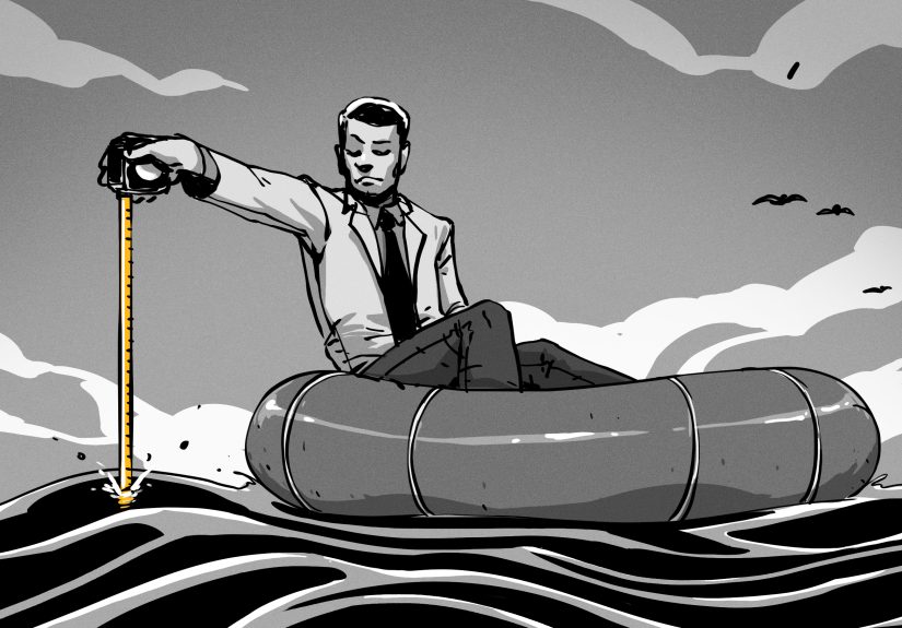
There is something oddly humbling about working with ocean buoy data. On land, it is easy to assume information will always be available. You open a dashboard, refresh a feed, or glance at a graph and expect the numbers to appear as if they were grown in a spreadsheet orchard. Out at sea, every data point feels a little more earned. Someone designed the platform, deployed the mooring, calibrated the instruments, checked the transmissions, and trusted that the equipment could survive weeks or months in a place that does not care about project deadlines.
Researchers and marine operators often describe buoy data as both routine and deeply personal. Routine, because the data arrive hour after hour, day after day, turning the ocean into a time series. Personal, because when one station goes offline during rough weather, you feel the absence immediately. It is not just missing information. It is like losing contact with a colleague stationed far offshore. The charts suddenly have a gap. The forecast feels a little less certain. Everyone starts asking the same question: is the buoy down, or is the ocean trying to tell us something the hard way?
For fishermen and boaters, buoy observations can shape practical decisions before sunrise. A quick look at wind speed, wave height, and water temperature may determine whether a trip is safe, productive, or worth postponing. For coastal scientists, long-running buoy records can become the backbone of entire studies. You begin to recognize seasonal rhythms, odd spikes, familiar transitions, and the signature of unusual events. After enough time, a buoy station stops feeling like a sensor package and starts feeling like a witness with an excellent memory.
There is also a strange comfort in real-time ocean data. The sea is vast and unpredictable, but buoy observations make it feel a little less unknowable. Not tame, never tame, but legible. A pressure trend hints at a front moving through. A rising wave period suggests energy arriving from a distant storm. A subtle shift in temperature may signal upwelling, mixing, or changing habitat conditions. The ocean starts to read less like chaos and more like a conversation, provided you know how to listen.
At the same time, buoy work teaches respect for uncertainty. Sensors foul. batteries weaken. moorings strain. storms interrupt neat expectations. Even the best data systems have limits, and experienced users learn not to treat a screen like a crystal ball. Instead, they combine buoy data with models, satellite imagery, local knowledge, and common sense. That balance is part of the real experience of ocean observing: confidence without arrogance.
In the end, one of the most memorable things about data buoys is how quietly essential they are. They do not ask for applause. They just keep measuring, transmitting, and helping people make smarter decisions. For anyone who has depended on them, whether for research, safety, or work at sea, that quiet reliability feels less like technology and more like trust.